
Aerial Photography & Videography
Elevate your project's impact with breathtaking high-quality aerial photos and videos. Our drone services capture stunning visuals from unique perspectives, perfect for a variety of applications:
Captivating Advertising & Marketing Materials: Grab attention and showcase your property, product, or event in a whole new light. Stunning aerial visuals can significantly boost engagement and brand awareness.
Detailed Project Documentation: Generate comprehensive visual records of construction sites, infrastructure, or real estate developments with precise aerial photography.
Enhanced Security & Surveillance: Gain a wider vantage point for security purposes. Aerial imagery can be a valuable asset for monitoring large areas or inspecting hard-to-reach locations.
We specialize in providing professional drone services for diverse industries:
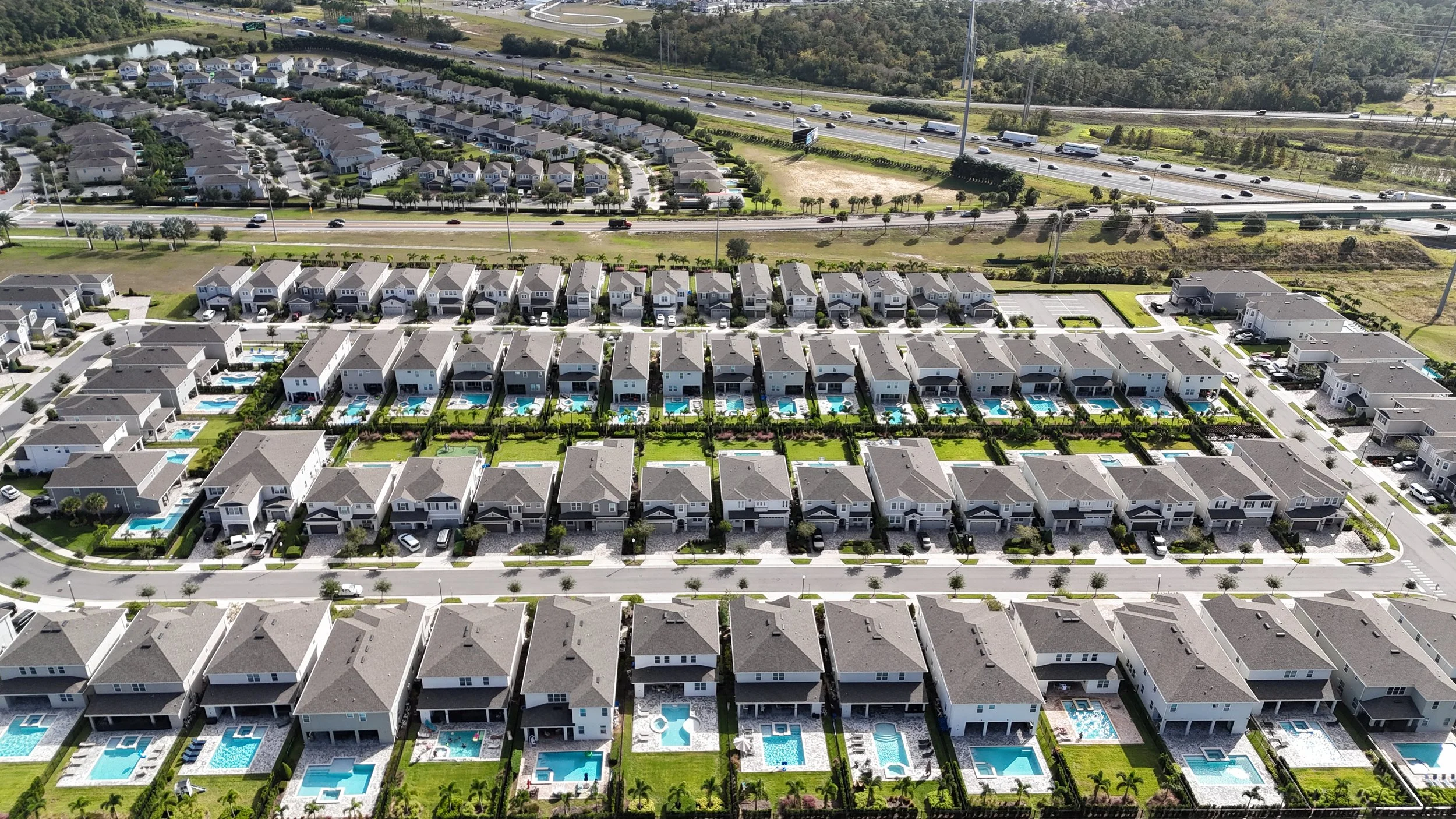
Real Estate: Showcase properties with breathtaking aerial views, highlighting key features and surrounding landscapes.
Construction: Monitor progress, document stages, and ensure safety with comprehensive aerial photography.
Events: Capture the energy and excitement of your event from a unique perspective, creating lasting memories.
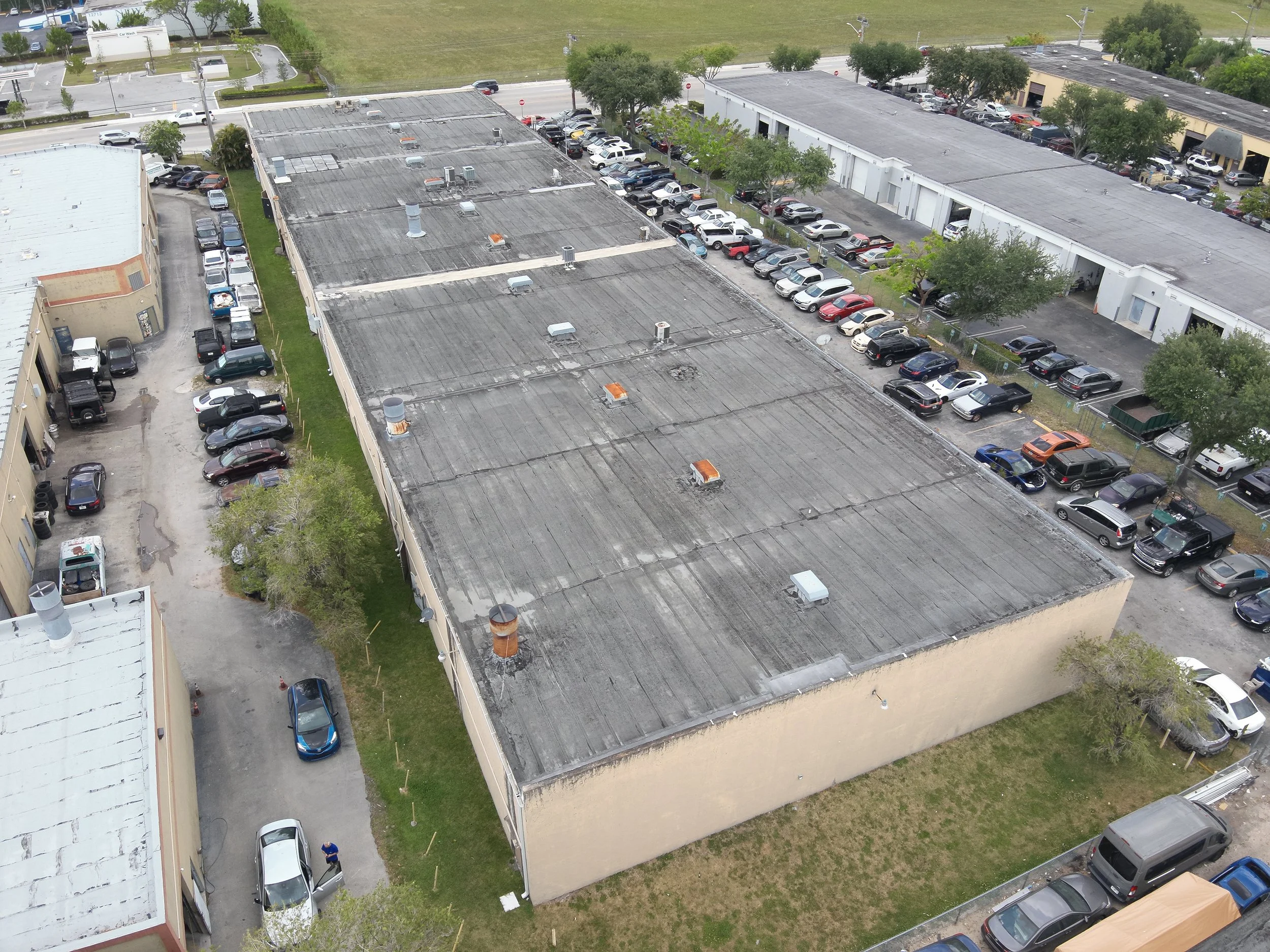
Inspections: Gain a bird's-eye view of hard-to-reach areas for efficient and thorough inspections of roofs, infrastructure, or wind turbines.
Marketing & Advertising: Create captivating content that sets your brand apart with stunning aerial visuals.
Professional Aerial Inspections
Traditional inspection methods can be time-consuming, risky, and limited in scope. Ditch the ladders and scaffolding
Benefits of Drone Inspections:
Enhanced Efficiency: Inspect large areas or hard-to-reach locations quickly and efficiently, minimizing downtime and disruption.
Safety: Eliminate the need for personnel to climb or work at dangerous heights, reducing the risk of accidents and injuries.
Precision: Capture high-resolution images and videos, providing detailed insights into the condition of your infrastructure, buildings, equipment, and other assets.
Cost-Effectiveness: Reduce overall inspection costs compared to traditional methods, saving time and resources.
Applications of Drone Inspections:
Roof Inspections: Identify and assess roof damage, leaks, and potential issues before they escalate into costly repairs.
Building Facade Inspections: Inspect building exteriors, cracks, and potential safety hazards without the need for scaffolding.
Infrastructure Inspections: Assess bridges, pipelines, wind turbines, and other infrastructure for wear and tear, corrosion, or damage.
Cell Tower Inspections: Perform detailed inspections of cell towers and telecommunication equipment without the need for personnel to climb.
Construction Progress Monitoring: Track construction progress efficiently and accurately with frequent aerial imaging.

Solar Site Inspection
Drones revolutionize solar site management by enhancing safety, efficiency, and precision.
Equipped with advanced imaging like thermal and high-resolution cameras, drones such as the DJI Mavic 3E, Air 3, and Matrice 30T quickly survey large solar installations, detecting defects and hotspots with pinpoint accuracy. They reduce labor costs by up to 40%, minimize risks by eliminating manual inspections, and deliver detailed 3D maps for planning and maintenance.
With long flight times, robust obstacle avoidance, and real-time data, these drones streamline operations, ensuring optimal performance and longevity for solar energy projects
Benefits of Thermal Drone Inspections:
Save Time & Money: Efficiently cover large areas and hard-to-reach locations, minimizing downtime and inspection costs.
Enhanced Safety: Eliminate the risks associated with climbing and scaffolding. Our certified pilots conduct inspections remotely.
Improved Efficiency: Gain valuable insights with detailed thermal images and high-resolution video for comprehensive analysis.
Proactive Maintenance: Identify potential problems early on, preventing costly repairs and extending asset lifespan.
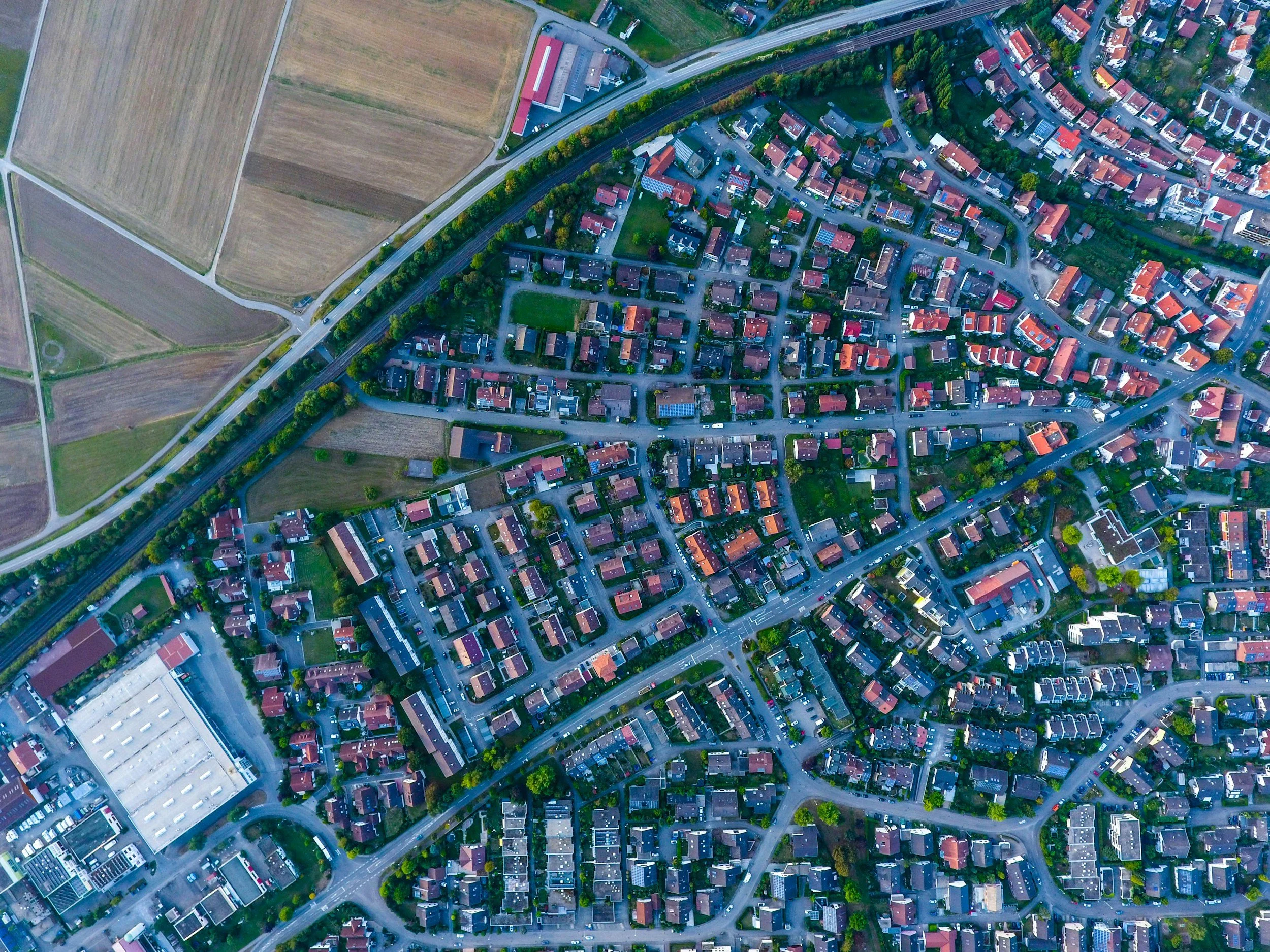
Mapping, Photogrammetry & Topographic Models
Revolutionize your project planning with high-accuracy data: Our state-of-the-art drone technology creates:
Detailed Photogrammetry: Generate precise 3D models from overlapping aerial photographs, perfect for infrastructure inspections, stockpile measurements, and cultural heritage preservation.
Customizable Maps: Create high-resolution 2D maps with valuable insights for land development, construction planning, and environmental monitoring.
Accurate Topographic Models: Develop detailed 3D representations of terrain features, critical for volume calculations, risk assessments, and excavation planning.
Benefits of Drone-Based Solutions:
Enhanced Accuracy: Capture precise measurements with minimal errors compared to traditional methods.
Unmatched Efficiency: Collect data over large areas quickly and safely, saving time and resources.
Cost-Effective Approach: Reduce overall project costs compared to manned aerial surveys or ground crews.
Data-Driven Decisions: Gain valuable insights with detailed visuals and precise measurements for informed decision-making.
Aerial Measurements
Tired of unreliable data and limited access for inspections and measurements?
Our high-resolution drone data capture services provide detailed aerial imagery and accurate measurements for a variety of applications:
Roof: Measure roof areas, and generate detailed reports for precise estimates and repairs without needing to walk on the roof.
Point-of-Interest Capture: Capture intricate details of buildings, infrastructure, or cultural heritage sites with exceptional clarity and precision, perfect for documentation and preservation efforts.
Benefits of Drone Data Capture:
Enhanced Safety: Eliminate the risks associated with climbing or scaffolding during inspections.
Improved Efficiency: Collect data over large or hard-to-reach areas quickly and cost-effectively.
Unmatched Accuracy: Gather precise measurements with minimal errors compared to traditional methods.
Data-Driven Decisions: Gain valuable insights with detailed visuals and accurate measurements for informed decision-making.
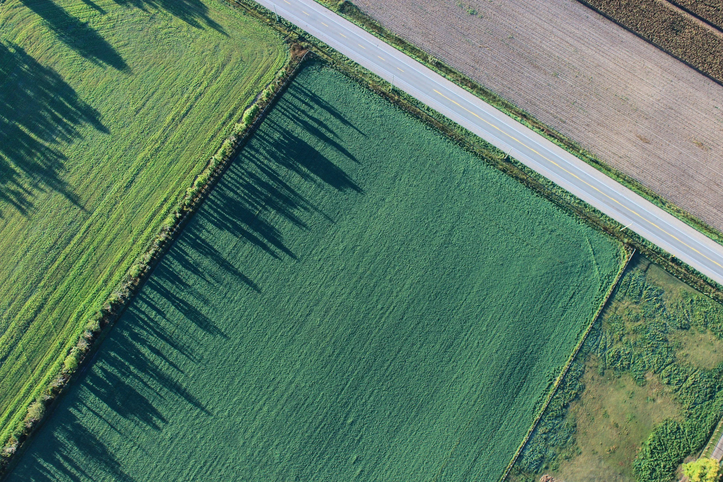
Environmental Monitoring
Protect the environment and promote sustainability with actionable data. Our advanced drone technology empowers businesses and organizations to monitor critical ecological concerns:
Pollution Detection & Tracking: Identify and track air, water, and soil pollution sources for targeted remediation efforts.
Deforestation Monitoring: Accurately assess deforestation rates and track forest health with high-resolution aerial imagery.
Land-Use Change Analysis: Monitor land-use changes over time to inform sustainable development practices.
Benefits of Drone-Based Environmental Monitoring:
Enhanced Coverage: Drones access hard-to-reach areas, providing a comprehensive view of environmental conditions.
Real-Time Data Collection: Gather data quickly and efficiently, enabling faster response times to environmental threats.
Cost-Effective Approach: Drones offer a cost-effective alternative to traditional monitoring methods like manned aircraft or ground surveys.
Data-Driven Decision Making: Gain valuable insights to develop effective conservation and sustainability strategies.
Our Equipment
-
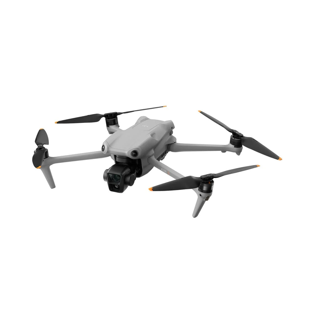
![DJI Air 3]()
DJI Air 3
DJI Air 3 is a High-Quality drone with Dual primary camera system: It can take 48MP photos and 4K HDR videos
Uses: Aerial photography/videography (landscapes, events).
Real estate and property mapping.
Recreational and prosumer content creation.
-
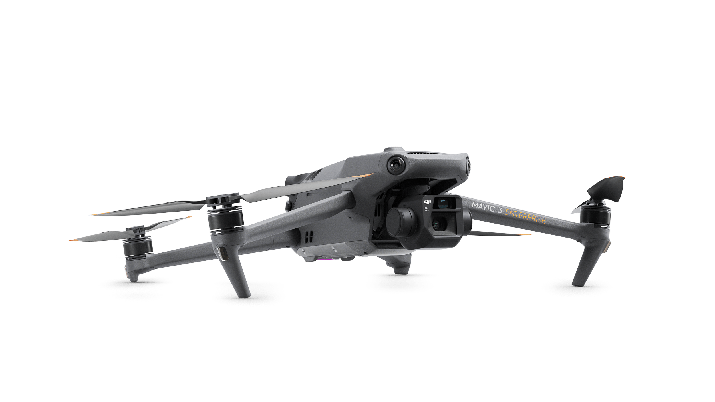
![Mavic 3 Enterprise RTK]()
Mavic 3 Enterprise RTK
Is a compact, enterprise-grade drone designed for professional mapping, surveying, and inspection missions. It features a 20MP wide-angle camera with a 4/3 CMOS sensor, a 56x hybrid zoom tele camera.
Uses: Surveying/mapping (construction, urban planning).
Infrastructure inspection (power lines, bridges).
Agriculture/environmental monitoring (crops, disaster response).
-
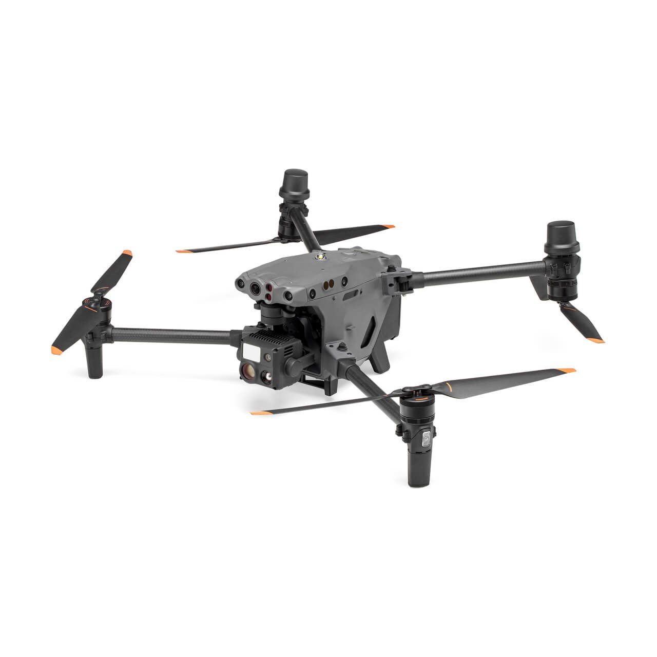
![Matrice 30T]()
Matrice 30T
The M 30T is a powerful and versatile drone that offers a number of features that make it ideal for a variety of professional applications.
Use: Search and rescue (thermal for locating people in low-visibility).
Infrastructure inspection (power lines, pipelines) with zoom and thermal.
Public safety and environmental monitoring (disaster response, fire detection).